No products in the cart.
Twin Peaks Maps
In a town like Twin Peaks, it's not hard to get lost. Here are all the Twin Peaks maps I've collected so far, but please let me know in the comments if you come across any other ones!
In a town like
Here are all the Twin Peaks maps I’ve collected so far, but please let me know in the comments if you come across any other ones!
You can find three maps in Twin Peaks: An Access Guide to the Town (Amazon), a wonderful little publication from back in 1991. When I was packing for my first trip to the filming locations in Washington state, my girlfriend took the guide from our book shelf and —completely unaware all of its content is fictional— handed it over to me so I would be able to find my way around. I love her so much!
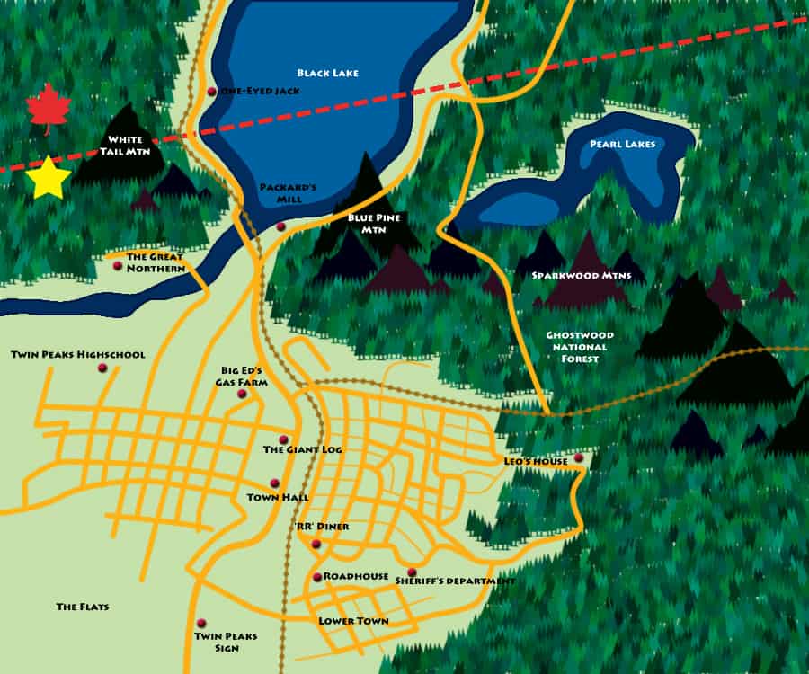
The first map in the book shows the location of our favorite lumber town within the Pacific Northwest. It’s close to the Canadian border, of course, but the actual filming locations are less than an hour east of Seattle, or about 30 miles instead of the said 256.

What’s interesting about the second map in the guide is that it clearly points to Glastonberry Grove. I guess that’s for all the recent tourists wishing to enter the Black Lodge?

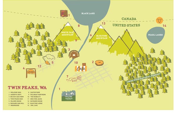
The city roadmap shows almost all the important sites, including The Great Northern Hotel, White Tail Falls, Black Lake Dam, Twin Peaks Town Hall, The Grange (burned), Palmer House, Briggs House, Hayward House, Twin Peaks High School, Black Lake Cemetery, Twin Peaks Sheriff’s Department, Upper Twin Park, The Gazebo, Lower Twin Park, County Museum, The Bookhouse, Old Railroad Depot, Double R Diner, Roadhouse, Horne’s Department Store, Calhoun Memorial Hospital, to Packard Place, to Packard Sawmill, to Owl Cave, to the Railroad Cemetery, to Ghostwood National Forest, Harold Smith’s Apartment, Dead Dog Farm, Big Ed’s Gas Station, to Unguin’s Field Observatory (U.F.O.), and Old Unguin’s Field.

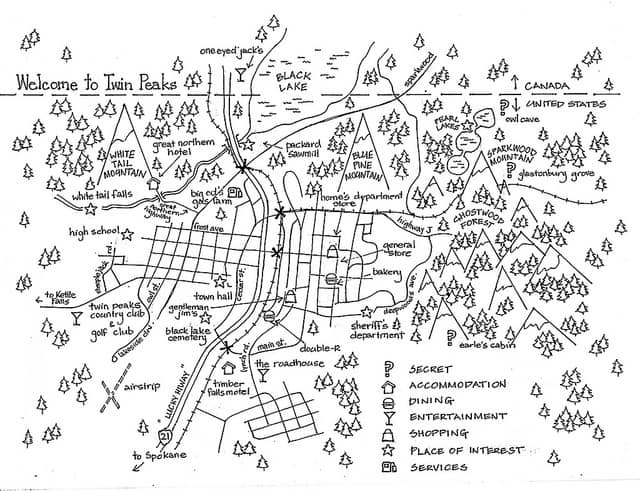
David Lynch’s map to Twin Peaks introduces some new names like White Tail mountain and Blue Pine mountain (the Peaks have names, ladies and gentlemen!), Sparkwood mountain, Meadow Lark Hill, and The Flatts. It also shows us the location of Pearl Lakes, where little Leland Palmer met a man called Robertson. And Lucky Highway 21.

Adding his own place markers to David Lynch’s original sketch, Charles Ramsey of intwinpeaks.com shows us where he imagines everything is located.

A very important Twin Peaks -related map —as discovered in the last episode by the ever-clever Deputy Andy Brennan— is this petroglyph exposed by Windom Earle in the Owl Cave. Special Agent Dale Cooper learns that by superimposing it on the map of Twin Peaks , it shows the entrance to the Black Lodge. There’s a print of the Owl Cave map available here.

A Japanese board game called The Game Of

When fiction meets reality. Twede’s, the restaurant that served as Norma’s Double R Diner in the pilot, is selling its own map to the surrounding filming locations in North Bend and Snoqualmie. Here’s a picture of that one.

Here’s another map to the film sites, quite possible courtesy of the old Alpine Blossom & Gift Shoppe in North Bend that used to sell

Robert Farkas‘ mom forbade him to watch

This is the map created for the studio-sponsored

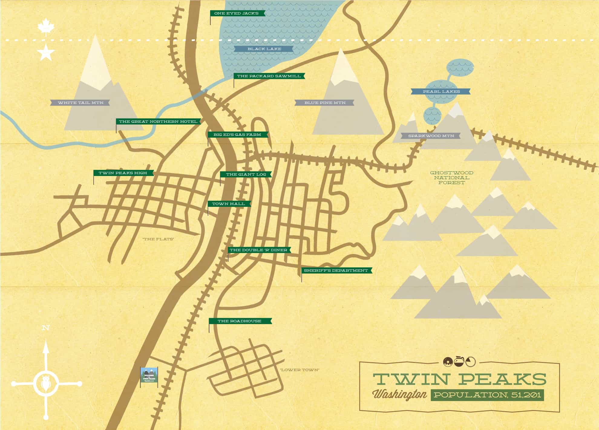
One of the most recent maps highlights all the must see spots in the fictional town and was created by M. Walton Keys for his sister’s 23rd birthday.

UPDATE (March 28 2013): A black and white map drawn by Helen aka Urban Dilettante. Also available as a t-shirt.
UPDATE #2 (May 30, 2013): A work-in-progress by Petar Genov.
UPDATE #3 (November 26, 2014): Jacquelin Schaab drew the map below. It’s also available as a print.
[wpebayads]


The one still missing map (for 20 last years) is the one from Twin Peaks Conference Room’s board (in many episodes)!
Let’s hunt that one down!
AAAHHHHHHHHHHHHHHHHHHH!!!
Wonderful! I love them all!
Now that’s what I call a damn file collection of TP maps. Thanks for sharing.
It seems like these maps have the location of the town a bit off from what Cooper says in the first episode:
“Diane, 11:30 a.m., February Twenty-fourth. Entering the town of Twin Peaks, five miles south of the Canadian border, twelve miles west of the state line”
The latest episode of Twin Peaks: The Return (112) has a scene with Diane inputing the Google Maps search phrase “coordinates+2”, which then shows a pinpoint of Twin Peaks about a 37 minute drive up highway 25 northeast of the town Kettle Falls in Washington. In between Dale Cooper’s location and the location near Danville. 🙂
That location of Twin Peaks is actually showing in google 🙂
Somewhere here…
Hi, I’m an illustrator and I did a map too!
Love this one. Sort of looks like a board game!
I’ve created the whole town (and Deer Meadow for that matter) in Minecraft, and here is the map that resulted:
Is it possible to download this Minecraft map from anywhere? Would be really interested in exploring it?
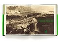
Discovered a New map today on Page 50 of the Book “Seattleness, A Cultural Atlas!” its pretty sweet
TWIN PEAKS Music and 1.,2.,3. Sezon film online.ru FIRE WALK WITH ME film online.ru Luxury Holding BRAND Inna Filipova (Inna-jaguar) DOLCE & GABBANA Latvija ??? Latvija ??.